The hike to Regurs and Fontanili, two places of the Costiera dei Cech, is easy and panoramic.
Shortly:
- Elevation Gain: 560 m.
- Hiking Time: 2/3 hours uphill, 1 h downhill
- Difficulty: E
- Max Elevation: 1400 m.
- Trail: well marked by white and red signs and trail markers
- Caution: the name of places cited, in particular Regurs and Fontanili, may differ from the toponymy of the hiking maps and other information that can be found on the web. Regurs: Rigorso, Rigors… – Fontanili: Funtanin…
Warning:
Trekking is an inherently dangerous activity. The hike here described can be a dangerous activity if faced without the right preparation. Mountain conditions can be very dramatically from one season to the next. Always seek local advice on current conditions, check the weather and don’t take anything for granted.
The author accepts no liability whatsoever for any loss, injury or inconvenience resulting from the use of this blog.
Starting point:
Caspano, that can be reached by taking the road that from Morbegno first passes the village of Dazio and then Serone. At the crossroad of Chempo’s village continue straight on the main road, cross a bridge and after a few meters you are in Caspano. Good parking area in front of the football field.
Trail Description:
From the parking of Caspano cross the village and go up towards the cemetery. Continue following the dirt track until a junction. Right for Regurs, left for Fontanili, this is the trail you’ll use for the descent.
Continue to the right for Regurs along a dirt track with slight and continuous ups and downs.
After about 30 minutes, at an altitude of 950 m, you’ll find on the right a trail that joins the dirt track you are walking. It’s a short variant that can be used walking up from Caspano, it allows you not to walk the first stretch until here.
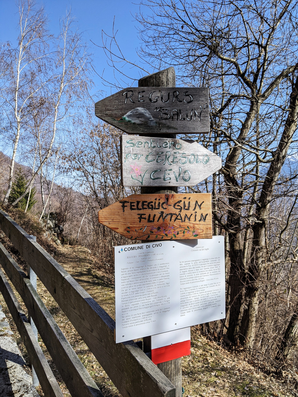
Then, after about 20 minutes, there is another junction with trail markers and a short but good report of the next trail to follow. Continue to the left, quickly reaching Regurs.
See the image below.
You will now leave the dirt track to follow a trail.
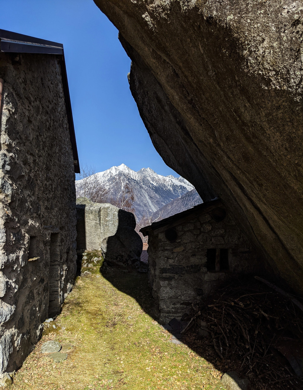
Walk to the left of the large and characteristic erratic boulder, the Balun, and continue climbing an excellent trail until you’ll reach a junction.
Continue to the right towards Funtanin (Fontanili).
Climb up passing near an isolated hut in Feleguc basso and then after crossing a large pasture with some ruins you reach another hut in Feleguc alto, at an altitude of 1350m.
Continue to the left along a flat stretch of trail towards Fontanili at the dirt track, at an altitude of 1400m, that you’ll reach in 10 minutes.
End of the uphill path.
Descent:
Follow the dirt track that descends from Fontanili to Caspano. In a hour you’ll reach the parking of Caspano.
It’s possible follow this itinerary in the opposite direction.
Connected trails:
- From Fontanili it is possible to go up quickly reaching the Pista Tagliafuoco, fire break track, of the Costiera dei Cech – see hike and continue the hike.
- Otherwise, it is possible to go down to Caspano following the Fontanili – Pra Sceresa – Ca’ dei Lurenzat trail – see hike (the hike described is reverse) in about 2 hours.
Other:
More hiking Costiera dei Cech. Hiking time, difficulty, elevation gain and tips.
Suggested Map: Kompass n°92. Warning! The itinerary is not indicated.
Serena