The hike along the Pista Tagliafuoco, fire break track, of the Costiera dei Cech takes place mainly on unpaved roads and it’s possible to traverse it by walk or by mountain bike. Easy trail.
Shortly:
- Elevation Gain: about 700 m.
- Hiking Time: 4/5 hours by walk, less by MTB
- Difficulty: E
- Max Elevation: 1500 m.
- Trail: not marked, there are some not very visible indications.
- Caution 1: the Pista Tagliafuoco, fire break track, of the Costiera dei Cech is not always accessible and it’s not regularly maintained. To consider the possibility of finding boulders and trees along the trail. During the winter and spring season there is a big avalanche above Fontanili, so its presence and crossing can make this hike dangerous and not always possible.
- Caution 2: despite being pleasant, this hike follows the forced path of a road that has “upset” this stretch of the Costiera dei Cech. In order not to further damage the already seriously compromised environment, I don’t recommend traversing the trail by motorbike or off-road vehicle.
Warning:
Trekking is an inherently dangerous activity. The hike here described can be a dangerous activity if faced without the right preparation. Mountain conditions can be very dramatically from one season to the next. Always seek local advice on current conditions, check the weather and don’t take anything for granted.
The author accepts no liability whatsoever for any loss, injury or inconvenience resulting from the use of this blog.
Starting point:
Caspano, that can be reached by taking the road that from Morbegno first passes the village of Dazio and then Serone. At the crossroad of Chempo’s village continue straight on the main road, cross a bridge and after a few meters you are in Caspano. Good parking area in front of the football field.
Trail Description:
From the parking of Caspano cross the village and go up towards the cemetery. Continue following the dirt track until a junction. Turn left to Fontanili and follow the long dirt track, after 1 hour there is another junction. Take the right (on the left there’s a barrier that prevents access) and after a few turns you’ll reach the Pista Tagliafuoco, fire break track.
Follow the fire break track towards the west with slight and continuous ups and downs for about 2 hours (by walk).
At about half hike it is possible to descend to Ledino and then to Poira di Civo through a marked trail, it’s not appropriate for MTB.
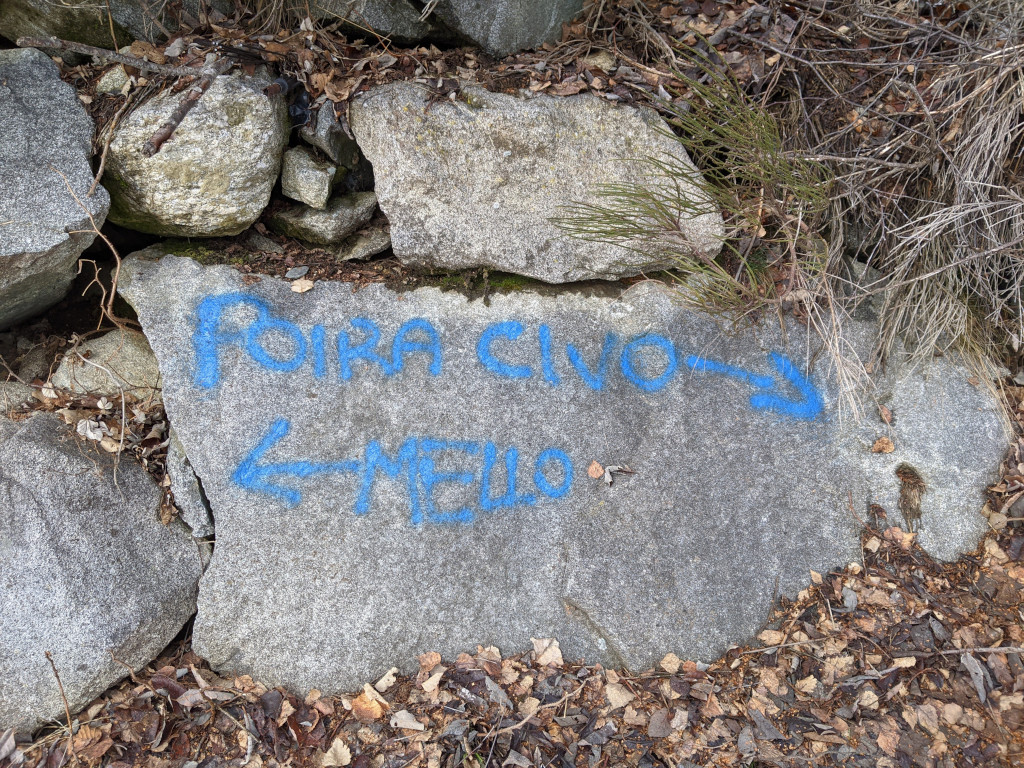
The Pista Tagliafuoco, fire break track, ends close to a turn on the left. From here go down to Pecoia area, near to Poira di Mello and then follow the few signs to Poira di Civo.
If you follow the route by walk, you can use an easy trail, while by MTB you need to follow the road (see the green line on the map below).
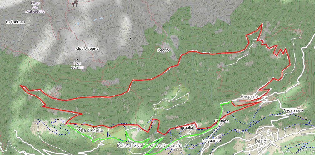
From Poira di Civo, near the Pizzeria da Cris, to return to Caspano, you can take the paved road (suggested for MTB, see the green line on the map above), or with a little patience and a sense of direction follow the trail that from the church of Poira di Civo leads to Roncaglia di Sopra, Chempo and then to Caspano.
Other:
Map modified by Open Street Map
Other hiking Costiera dei Cech
Video Pista Tagliafuoco Costiera dei Cech
Serena